Dharti Survey - Land Surveyors ☏ +91 98243 33470
What Is a Topographic Survey and Why It’s Important for Construction Projects in Ahmedabad
Discover how topographic surveys help in accurate planning, design, and construction across Ahmedabad and Gujarat.
Team Dharti Survey
11/5/20251 min read
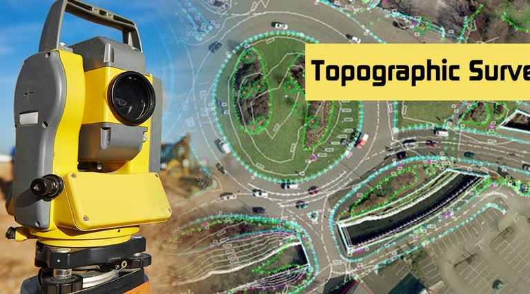

When it comes to land development and construction projects in Ahmedabad, one of the first and most important steps is conducting a Topographic Survey. This survey provides a detailed representation of both natural and man-made features of a land parcel — essential for planning and engineering design.
🏗️ What Is a Topographic Survey?
A topographic survey maps the physical features of the land such as trees, roads, buildings, water bodies, and elevation levels. It helps architects, engineers, and developers understand the existing terrain before starting construction or layout planning.
🌐 Why It’s Essential for Construction Projects
Accurate Site Planning – Engineers can design foundations and structures according to real site elevations.
Prevents Design Errors – Identifies slopes, drainage, and elevation differences early.
Saves Cost and Time – Eliminates rework caused by inaccurate ground levels.
Legal Compliance – Ensures proper site documentation and approvals.
🧰 How Dharti Survey Performs Topographic Surveys
At Dharti Survey, we use Total Station and DGPS instruments for highly accurate mapping. Our experienced surveyors ensure that every contour and detail is captured precisely, making your project planning smoother.
📍 Service Areas
We offer topographic survey services in Ahmedabad, Kheda, Anand, Vadodara, and other parts of Gujarat.
Dharti Survey — your trusted partner for land surveying solutions with accuracy, technology, and experience.
Services
We offer reliable land surveying services in Mahemdavad, District Kheda and Ahmedabad.
Contact
B-104, City Point Complex, Haldharvas Modaj Road, Mahemdavad, Kheda, Gujarat. 387110
© 2025. All rights reserved.
Bhathi Zala ☏ +91 98243 33470
Dinesh Zala ☏ +91 98243 33477
Rajesh Zala ☏ +91 98243 33478
Office
✉️ Our Email