Dharti Survey - Land Surveyors ☏ +91 98243 33470
DGPS vs Total Station: Which Survey Method Is Best for Your Project in Gujarat?
Understand the difference between DGPS and Total Station surveys and learn which one suits your land project in Gujarat.
Team Dharti Survey
11/5/20251 min read

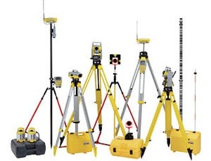
Surveying technology has evolved rapidly in recent years, offering multiple options for achieving precise land measurements. Two of the most commonly used tools in modern surveying are the DGPS (Differential Global Positioning System) and the Total Station. Both are accurate — but serve different purposes.
📍 What Is a Total Station Survey?
A Total Station uses an electronic distance measurement (EDM) system combined with angular measurement. It’s ideal for building layouts, road alignments, boundary demarcation, and contour surveys.
Advantages:
High accuracy for short and medium ranges
Real-time data and quick results
Suitable for construction and boundary work
🌐 What Is a DGPS Survey?
DGPS relies on satellite signals and base stations to provide highly precise coordinates — often within 2–5 cm accuracy. It’s ideal for large-scale mapping, infrastructure development, and government projects.
Advantages:
Covers large areas efficiently
Provides accurate latitude-longitude data
Useful for GIS mapping and master planning
⚖️ Which One to Choose?
For building and plot-level work: Total Station
For large infrastructure and mapping: DGPS
🧭 Dharti Survey’s Expertise
At Dharti Survey, we combine both technologies to ensure accuracy and efficiency. Whether it’s a land development project in Ahmedabad or a highway alignment in Kheda, our team provides the right surveying solution for your needs.
Choose smart surveying — choose Dharti Survey, Gujarat’s trusted partner for DGPS and Total Station services.
Services
We offer reliable land surveying services in Mahemdavad, District Kheda and Ahmedabad.
Contact
B-104, City Point Complex, Haldharvas Modaj Road, Mahemdavad, Kheda, Gujarat. 387110
© 2025. All rights reserved.
Bhathi Zala ☏ +91 98243 33470
Dinesh Zala ☏ +91 98243 33477
Rajesh Zala ☏ +91 98243 33478
Office
✉️ Our Email